About Kataster24

Kataster24 is an independent information tool that combines public data from the Slovak land registry, the Address Register and risk maps into one report.

It grew out of the same idea as our Latvian project kadastra.lv: anyone buying land, a house or a flat should have all public information in one place – clear and free.

Where our data comes from

What we don’t do

We don’t show or store the names of private-person owners (only the owner type and shares), and we don’t replace an official extract of the ownership sheet. Kataster24 is not affiliated with ÚGKK SR or any other state body.

Contact: [email protected]
An unchecked plot
is an expensive mistake.

Landslides, radon and soil quality on the map
📍 All of Slovakia

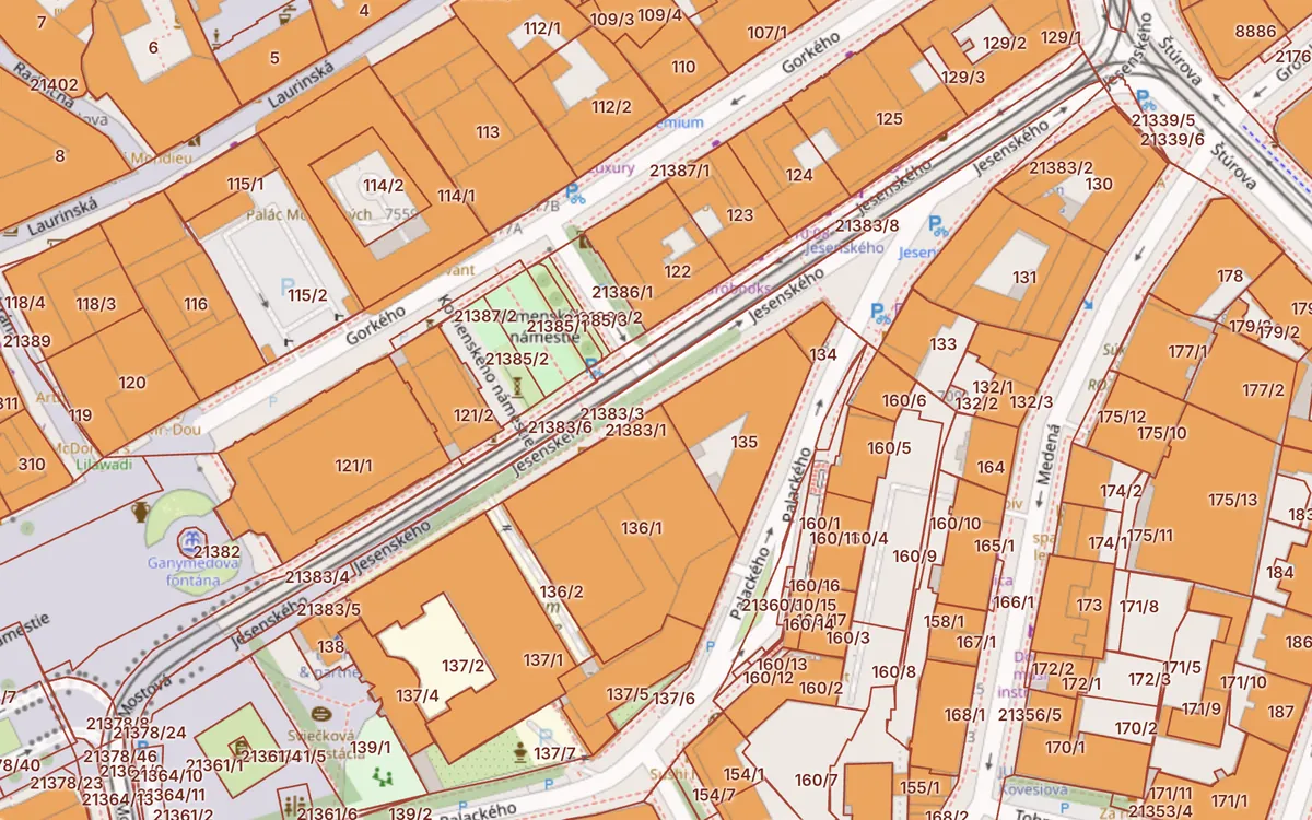
Cadastral map with C and E parcels

Click a plot to see its parcel number, area, land type, ownership sheet (LV) number and the risks at that spot.

C and E parcelsBuildingsEncumbrancesAerial photoLandslidesRadonBPEJNatura 2000Noise
Open the cadastral map →
Cadastral map of Bratislava with parcel boundaries and buildings Open the map →
Data collected from public sources
  • ÚGKK SR
  • ESKN
  • INSPIRE
  • ZBGIS
  • Address Register
  • ŠGÚDŠ
  • VÚPOP
  • EEA
  • OpenStreetMap

One page for every question about a plot

Parcel report

Parcel number, area, land type and use, built-up area status, LV number, buildings and flats on one page.

Check a parcel →

Cadastral map

Register C and E parcels, buildings, encumbrances, cadastral areas and aerial photos for all of Slovakia.

Open the map →

Risks at the location

Landslides, radon, Natura 2000, protected areas, mineral deposits, environmental burdens and noise.

Show risks →

House and flats

Registry number, entrances, number of flats and floors from the Address Register. Find a flat by address.

View a house →

From address to report in three steps

  1. Enter a parcel or addressFor example “Staré Mesto 10309” or “Obchodná 10, Bratislava”.
  2. We combine the sourcesÚGKK cadastre, Address Register, ŠGÚDŠ geological survey, VÚPOP soil institute and the European Environment Agency at once.
  3. You get the reportParcel data, the house and risks at the location. Check the owner in one click in the official ZBGIS.

Frequently asked questions

Check the plot before it becomes your problem.

One check takes 30 seconds and can save tens of thousands of euros.

Check a parcel now →