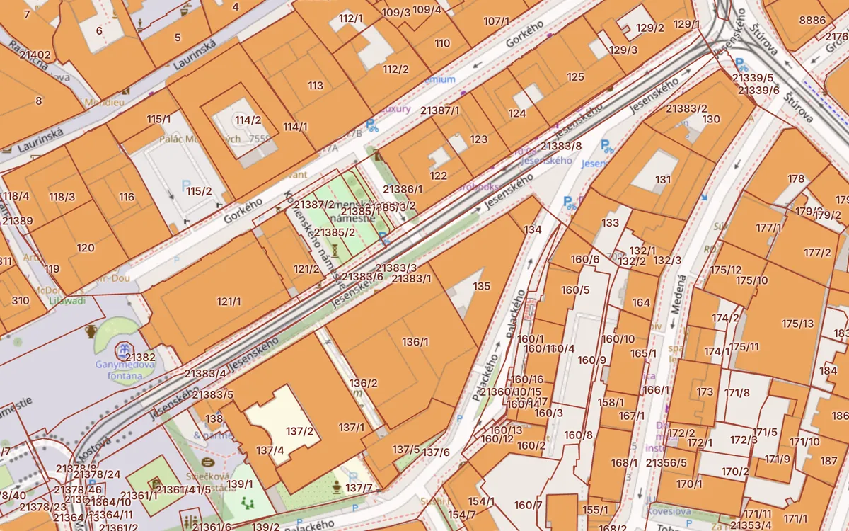
What is ZBGIS
ZBGIS (Základná báza údajov pre geografický informačný systém – the base dataset for the geographic information system) is the state database of spatial data. The public can access it through the ZBGIS map client, which replaced the older MAPKA application. For cadastral purposes, the key theme is “Kataster nehnuteľností” (Real Estate Cadastre, shown in pink), which displays parcels, buildings and ownership sheets.
How to find a parcel in ZBGIS
- Open the ZBGIS map client and switch the theme to “Kataster nehnuteľností”.
- Select a katastrálne územie (cadastral area) or municipality and lock it using the padlock icon. Without locking it, searching by parcel or LV does not work.
- Enter the parcel number, the ownership sheet number, the building’s súpisné číslo (registry number) or the owner’s name.
- Click a result and the map will move to the parcel and open its details.
How to view the ownership sheet
In the parcel details, click the list vlastníctva (LV, ownership sheet) number. ZBGIS offers an informative extract (partial or full), which is free but has no legal force. For a contract or a bank you need an official extract from the LV.
- The search finds nothing because the cadastral area is not locked.
- On a mobile phone the controls are hard to hit with a finger.
- On a poor connection the layers take a long time to load.
- Risks, buildings and flats are in other applications or not available at all.
A faster alternative: Kataster24
On the Kataster24 cadastral map you simply type “area + parcel number” or an address – there is nothing to lock. Click a plot and you will see its area, land type, LV number, buildings, flats in the building and risks at the location. To verify the owner, one button takes you back to the official ZBGIS, directly at that parcel.
Kataster24 is an independent tool and is not affiliated with ÚGKK SR. We take the data from public state services and display it directly from the source.
Frequently asked questions
Is ZBGIS free?
Yes. Browsing the map and the informative extract from the ownership sheet are free of charge. An official extract for legal purposes is subject to an administrative fee.
Can you search by owner name in ZBGIS?
Yes, in the Kataster nehnuteľností theme within a locked cadastral area. Kataster24 does not offer this feature – we do not process owners’ names.
Why is ZBGIS not working?
Most often because the cadastral area is not locked, or because of an outage of ÚGKK services. During an outage, try the Kataster24 cadastral map, which combines several sources.
Related guides
Check a plot in 30 seconds
Enter a parcel or an address to see cadastral data, buildings, flats and risks.
Check a parcel →