Mapka GKÚ: what it was and where to find the cadastral map today

“Mapka” was a popular application from the Geodetický a kartografický ústav (GKÚ, Geodetic and Cartographic Institute) for viewing the cadastral map. It has since been replaced by the ZBGIS map client, but people still search for it under its old name.

What MAPKA was

MAPKA (Mapový klient katastra nehnuteľností – the Real Estate Cadastre map client) was run by GKÚ Bratislava. It showed the cadastral map, register C and E parcels and links to ownership sheets. It also worked on mobile phones and needed no installation.

What replaced it

MAPKA’s functions were taken over by the ZBGIS map client in the “Kataster nehnuteľností” (Real Estate Cadastre) theme. However, the controls are more complicated: you have to select and lock a katastrálne územie (cadastral area) and find your way through many layers.

A simple cadastral map

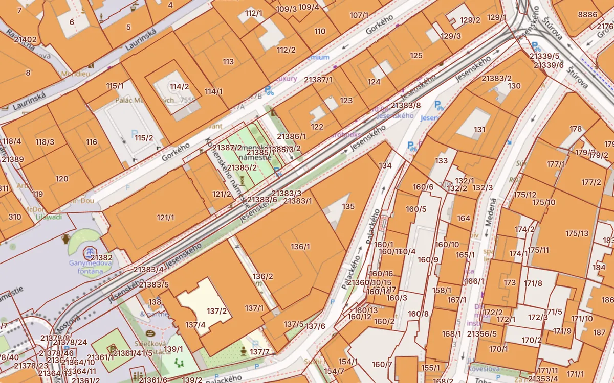
If you just want to find a parcel quickly, use the Kataster24 cadastral map:

The data comes from the same public services of ÚGKK SR. Kataster24 is not a state application.

Frequently asked questions

Does mapka.gku.sk still work?

The original MAPKA application has been replaced by the ZBGIS map client. You can find the cadastral map in ZBGIS or on Kataster24.

Is the cadastral map free?

Yes. Viewing the cadastral map is free of charge in ZBGIS and on Kataster24.

Related guides

Check a plot in 30 seconds

Enter a parcel or an address to see cadastral data, buildings, flats and risks.

Check a parcel →
An unchecked plot
is an expensive mistake.

Landslides, radon and soil quality on the map
📍 All of Slovakia

Cadastral map with C and E parcels

Click a plot to see its parcel number, area, land type, ownership sheet (LV) number and the risks at that spot.

C and E parcelsBuildingsEncumbrancesAerial photoLandslidesRadonBPEJNatura 2000Noise
Open the cadastral map →
Cadastral map of Bratislava with parcel boundaries and buildings Open the map →
Data collected from public sources
  • ÚGKK SR
  • ESKN
  • INSPIRE
  • ZBGIS
  • Address Register
  • ŠGÚDŠ
  • VÚPOP
  • EEA
  • OpenStreetMap

One page for every question about a plot

Parcel report

Parcel number, area, land type and use, built-up area status, LV number, buildings and flats on one page.

Check a parcel →

Cadastral map

Register C and E parcels, buildings, encumbrances, cadastral areas and aerial photos for all of Slovakia.

Open the map →

Risks at the location

Landslides, radon, Natura 2000, protected areas, mineral deposits, environmental burdens and noise.

Show risks →

House and flats

Registry number, entrances, number of flats and floors from the Address Register. Find a flat by address.

View a house →

From address to report in three steps

  1. Enter a parcel or addressFor example “Staré Mesto 10309” or “Obchodná 10, Bratislava”.
  2. We combine the sourcesÚGKK cadastre, Address Register, ŠGÚDŠ geological survey, VÚPOP soil institute and the European Environment Agency at once.
  3. You get the reportParcel data, the house and risks at the location. Check the owner in one click in the official ZBGIS.

Frequently asked questions

Check the plot before it becomes your problem.

One check takes 30 seconds and can save tens of thousands of euros.

Check a parcel now →