
In short
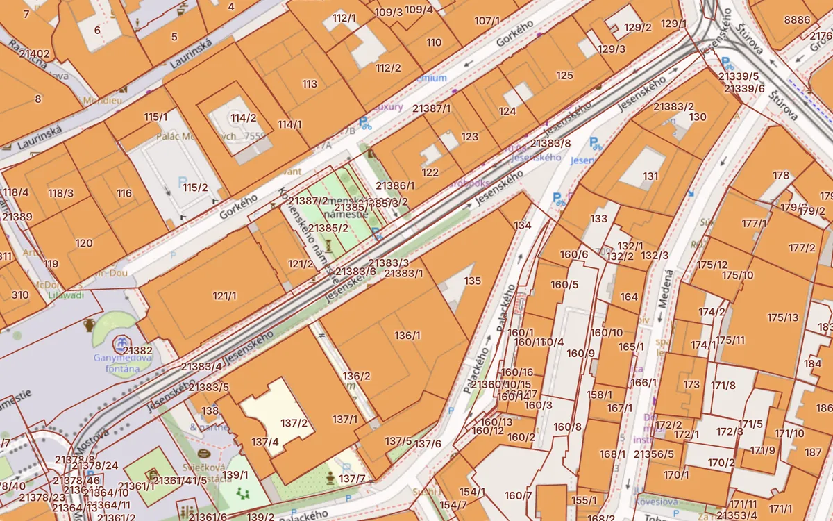
- Turn on the ZBGIS cadastral map with the “Real Estate Cadastre” theme; parcel numbers show when zoomed in.
- ZBGIS can measure distance and area, print to PDF and share a link to a parcel.
- A simpler map with risks and aerial photo in one click: the Kataster24 cadastral map.
Updated 13. 10. 2026 · Sources: ÚGKK SR, ZBGIS, public state registers
Themes and layers
ZBGIS is split into themes. For the cadastre you need “Real Estate Cadastre”, which turns on the cadastral map. In it you can toggle:
- register C parcels – boundaries and numbers as on the ground,
- register E parcels – original ownership parcels,
- buildings and their registry numbers,
- cadastral area boundaries,
- orthophoto as a background (aerial image).
Parcel numbers appear only when zoomed in a lot (roughly from 1 : 2,000). If you cannot see them, zoom in.
Measuring distance and area
The toolbar has a measuring tool. Click on the map to draw a line or an area and ZBGIS shows the length in metres and the area in m². The result is indicative – the official parcel area is in its detail.
Printing and sharing
Print the map to PDF with the print tool. To share, copy the page address – it contains the position and scale. A link to a specific parcel looks like …/mapka/sk/kataster/detail/kataster/parcela-c/{area code}/{number}.
- The cadastral map may not match the orthophoto exactly – differences of a few metres are common.
- A vector map (VKM) is not available everywhere; some areas only have a less precise non-numeric map.
- The area recorded in the cadastre may differ from the area measured on the map.
A simpler cadastral map: Kataster24
The Kataster24 cadastral map uses the same state data without themes or locking. C and E parcels, buildings, encumbrances, orthophoto and risk maps (landslides, radon, floods, noise) are one click away, and on mobile the map goes full screen.
Frequently asked questions
Where do I turn on the cadastral map in ZBGIS?
Switch the theme to Real Estate Cadastre. In the layer list you can then toggle C and E parcels, buildings and cadastral area boundaries.
Why can't I see parcel numbers?
Numbers appear only when zoomed in a lot. Zoom in to street level.
Can I measure a plot's area in ZBGIS?
Yes, with the measuring tool. The result is indicative; the official area is in the parcel detail.
Related guides
Check a plot in 30 seconds
Enter a parcel or an address to see cadastral data, buildings, flats and risks.
Open the cadastral map → Slovak land registry online →