
In short
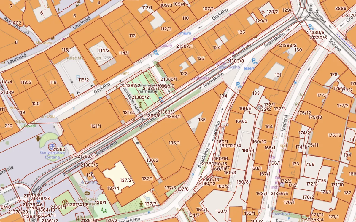
- Parcels are in the ZBGIS “Real Estate Cadastre” theme – enter the number with its subdivision (e.g. 1016/1).
- Register C = situation on the ground, register E = original ownership parcels.
- Find a parcel without locking an area on the Kataster24 cadastral map.
Updated 13. 10. 2026 · Sources: ÚGKK SR, ZBGIS, public state registers
Where parcels are in ZBGIS
The ZBGIS map client of ÚGKK SR has several themes. Parcels are in the “Real Estate Cadastre” theme. The default ZBGIS theme shows only a topographic map, so if you see no parcels, switch the theme first.
How to find a parcel by number
- Open ZBGIS and switch the theme to “Real Estate Cadastre”.
- Type the municipality or cadastral area and lock it with the padlock icon.
- Enter the parcel number, e.g.
1016/1. The slash separates the main number and the subdivision. - Choose whether it is a register C or E parcel and click the result. The map moves to the plot and opens its detail.
C and E parcels – the difference
A register C parcel matches the situation on the ground and is drawn in the cadastral map. A register E parcel comes from the original land book and the restored land register (ROEP) – it often lies under several C parcels. Some land has an ownership sheet only for the E parcel. See C and E parcels.
What the parcel detail shows
- parcel number and cadastral area,
- area in m²,
- land type (arable land, built-up area, garden…),
- ownership sheet (LV) number,
- whether it lies inside or outside the built-up area.
- the cadastral area is not locked,
- the parcel is in register E but you search in C (or vice versa),
- the number is entered without its subdivision (1016 instead of 1016/1),
- the parcel was split by a survey plan and has a new number.
A faster way: parcels on Kataster24
On the Kataster24 cadastral map you simply type “area + parcel number” (e.g. “Staré Mesto 10309”) or an address – nothing to lock. C and E parcels are drawn together and a click shows the area, land type, LV number, buildings and risks. One button opens the same parcel in the official ZBGIS.
Frequently asked questions
How do I find a parcel in ZBGIS by number?
Switch to the Real Estate Cadastre theme, lock the cadastral area and enter the parcel number with its subdivision, e.g. 1016/1. Then pick register C or E.
Why can't I see parcels in ZBGIS?
You probably have the default ZBGIS theme on. Parcels appear only in the Real Estate Cadastre theme and only when zoomed in.
Is parcel search free?
Yes. Browsing the cadastral map in ZBGIS and on Kataster24 is free and needs no sign-up.
Related guides
Check a plot in 30 seconds
Enter a parcel or an address to see cadastral data, buildings, flats and risks.
Open the cadastral map → Slovak land registry online →